Welcome to our blog ! Here you will find news and updates about sports, politics, artists, and everything that is trending right now. Enjoy the content and stay up to date with the latest trends! Stay Informed with BoomViral News.

"Monolithic Dust Wall Sweeps Across Illinois: Visual Documentation Chronicles Severe Meteorological Event as Authorities Issue Urgent Weather Alerts — Historic Parallels to 1934 Dust Bowl Phenomenon"
Suraay
5/17/20251 min read
Dramatic Dust Storm Sweeps Illinois, Prompting Statewide Warnings and "Life-Threatening" Travel Conditions
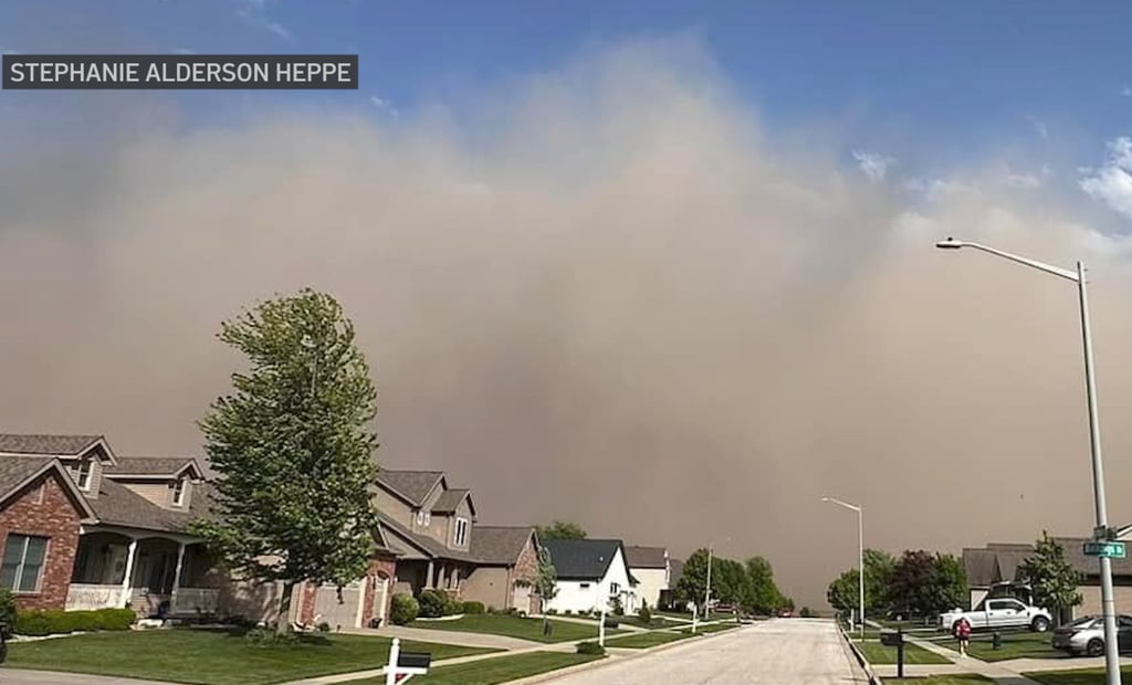
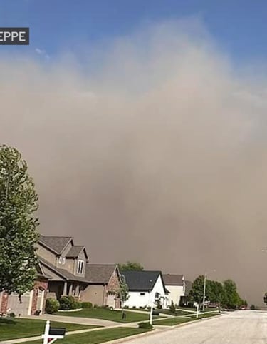
Startling footage and photographs documented an intense meteorological phenomenon across Illinois on Friday, as towering dust clouds engulfed regions from central farmlands to the Chicago metropolitan area. Authorities issued urgent warnings for multiple counties, including Cook, DuPage, and Lake, after the National Weather Service (NWS) reported near-zero visibility and wind gusts exceeding 60 mph.
Timeline of the Event
4:45 p.m. CT: A massive dust wall, spanning from El Paso, Illinois, to Otterbein, Indiana, began advancing northeastward, carrying particulate matter from drought-impacted farmlands.
5:00 p.m.: Residents in Normal, Illinois, captured harrowing images of a dust avalanche descending on residential areas, coinciding with McLean County’s dust storm warning (active until 6:45 p.m.).
6:45 p.m.: Chicago’s skyline vanished behind a sepia-toned haze, with visibility plummeting as the storm engulfed downtown. A time-lapse video from the Hancock Building illustrated the rapid encroachment, swallowing skyscrapers within minutes.
Transportation Chaos
The NWS linked the storm to a multi-vehicle collision on Interstate 74 in DeWitt County, while Livingston County officials reported “rapidly deteriorating” conditions on I-55 south of Bloomington. By evening, critical stretches of major highways—including I-80, I-90, I-94, and I-294—were deemed “life-threatening” due to near-zero visibility. Closures affected:
Illinois: I-39 (mile markers 66–77), I-55 (250–269), I-57 (339–358), and multiple Chicago-area expressways.
Indiana: I-80/94 near the state line and I-65 south of Merrillville.
Meteorological Context
The storm, fueled by sustained winds over 60 mph, marked Chicago’s first dust storm warning since the 1934 Dust Bowl. While particulate concentrations began easing by 7:40 p.m., the NWS cautioned residents about lingering reduced visibility and isolated thunderstorms in northern suburbs.
Historical Parallels
This event reignited discussions about climate resilience in agricultural regions, drawing direct comparisons to the 1930s Dust Bowl. Officials emphasized the role of prolonged drought and soil degradation in central Illinois as catalysts for the unprecedented atmospheric conditions.
Related Coverage
Satellite imagery reveals Midwest dust storm’s staggering scale
Experts analyze causes behind Chicago’s historic dust storm warning
Suraay